Tank Lakes – Backpacking the Necklace Valley Trail
We did a one night backpack through the Necklace Valley to camp at Tank Lakes on a warm and hazy fall weekend in mid-September. This backcountry adventure in the Skykomish/Stevens Pass area has it all: a lush valley floor that leads to alpine lakes and jagged peaks.
The beauty of the Necklace Valley Trail (#1062) is that there are many campsites to choose from, so you can modify your adventure by shortening or lengthening your hiking distance compared to our trek.
The Details
- Permits: Northwest Forest Pass in order to park at the trailhead; register your group for free at the trailhead
- Dogs: allowed!
- Campfires: not allowed!
- Getting There: start at the Necklace Valley Trailhead (aka East Fork Foss). The road to the trailhead should be accessible by any car. The parking lot is medium-sized with a pit toilet, but there is a lot of room for parking along the adjacent forest road (NF-68).
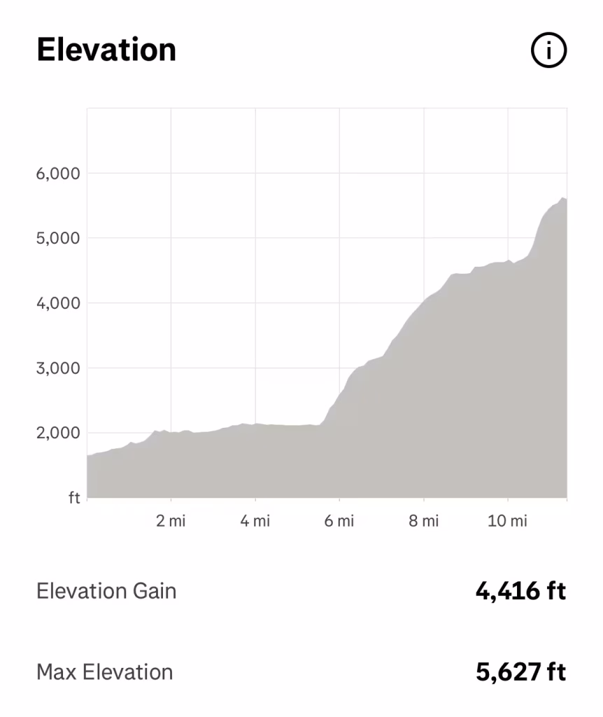
- The Trail: we did an out-and-back to Tank Lakes: 23 miles roundtrip, 4500’ elevation gain
- Note that there are many campsites along the entire length of the Necklace Valley Trail, so you could choose to do a shorter trip by camping at one of several other established sites before reaching Tank Lakes (read on below for more detail) and then doing a day hike to Tank Lakes.
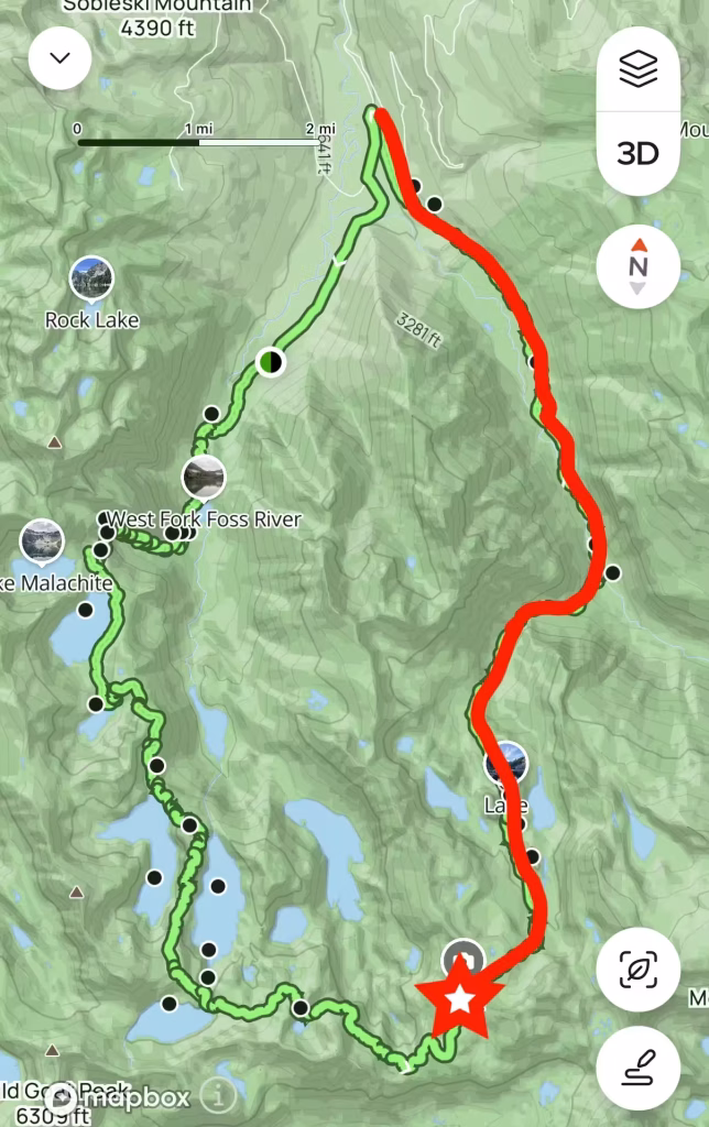
- Another popular option is a multi-night backpack as a full loop connecting Necklace Valley Trailhead (East Fork Foss) to the West Fork Foss River trailhead. This is referred to as the Alpine Lakes High Route. If doing this clockwise, you would continue past Tank Lakes to complete the loop and end at West Fork Foss River Trailhead, then hike another 2.5 miles on the forest road (NF-68) to return to your car at Necklace Valley Trailhead.
- Reports vary, but this may be upwards of 27-30 miles and 9k feet of elevation gain, and the going is slower than you would expect due to the rugged, rooty trails and scree.
The Experience
Day 1
We arrived at a full but quiet parking lot and boots were on the trail by 10:45am.
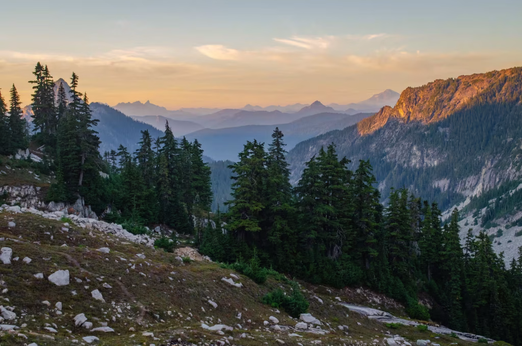
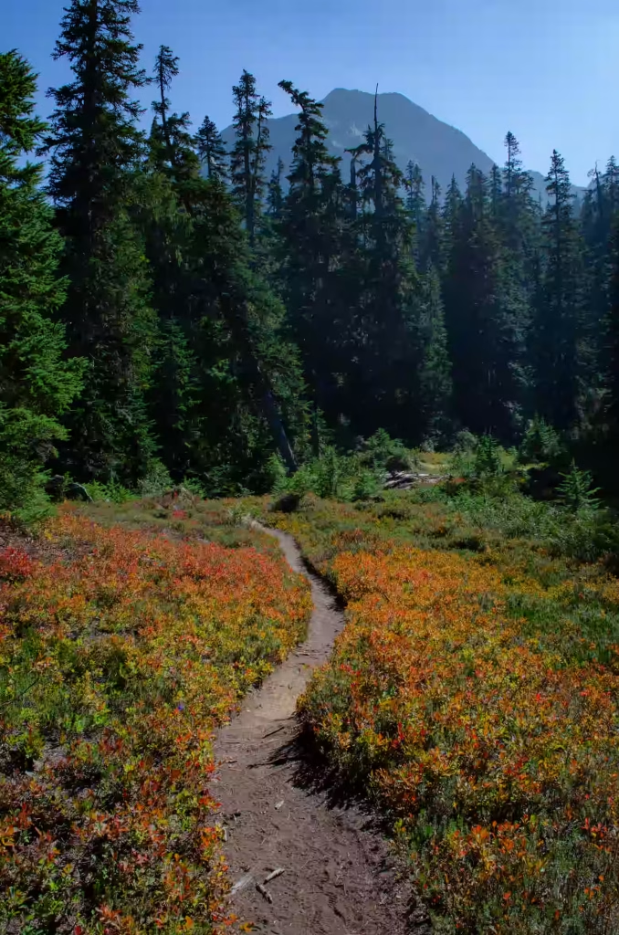
About 3.6 miles in you’ll reach your first set of riverside campsites. At 5 miles you will find a backcountry toilet to the left and more campsites to the right by the river. The entire trail thus far is smooth and easy meandering through shady, old-growth forest – perfect if you wanted to stop here for a beginner backpacking trip or a family-friendly day hike. You will only gain 600’ elevation in these first 5 miles.

Another half mile later (5.5 miles from TH), you will reach a very large log – walk along this natural bridge in order to cross to the other side and reach a small boulder field. By mid-September, the riverbed underneath was completely dry. Then, once you cross the log, don’t make our mistake and go straight up! Instead, bear right and you’ll see a dirt path with a cairn ahead. Follow this pathway upwards and then the strenuous ascent begins. You will climb more than 2,550 feet in 2 miles until you reach Jade Lake. There is one solid spot for water access halfway between the valley floor and Jade Lake if filtration is needed.
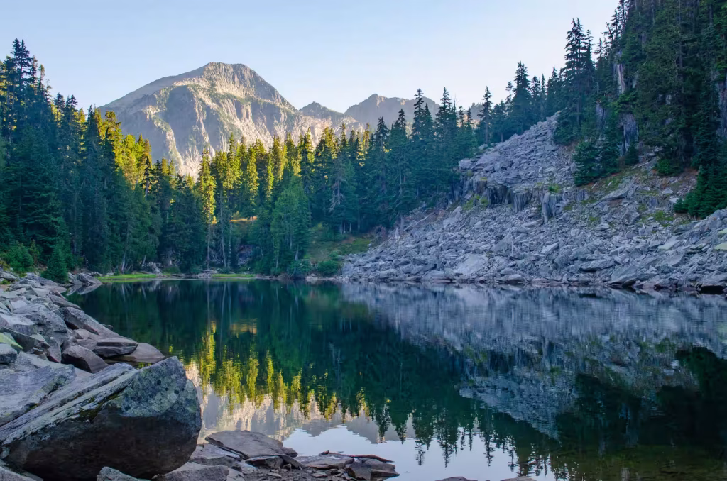
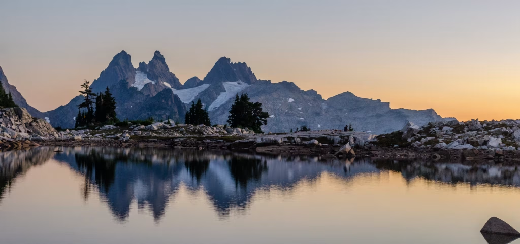
At Jade Lake there are a few campsites to choose from. It is very pretty here – reaching this point felt like a huge accomplishment. We stopped here to filter more water and rest before continuing on.
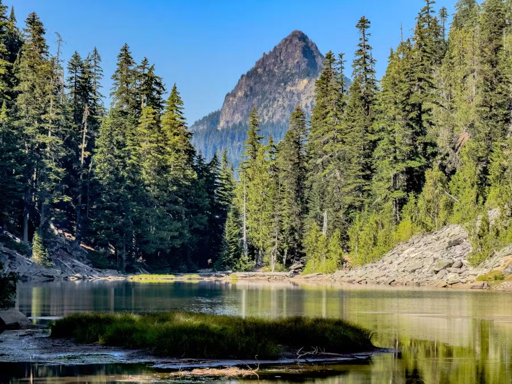
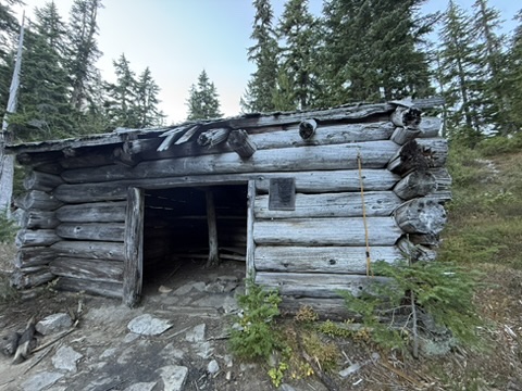
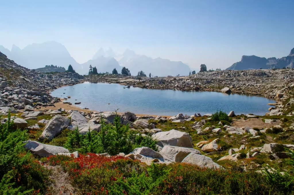
Soon afterwards we came across a historic cabin – this denotes the Emerald Lake area. Reach the campsites here by going down towards the lake. There are also campsites by Ilswoot Lake and Opal Lake, which are next. We did not stop at these lakes as our goal was to camp at Tank Lakes.
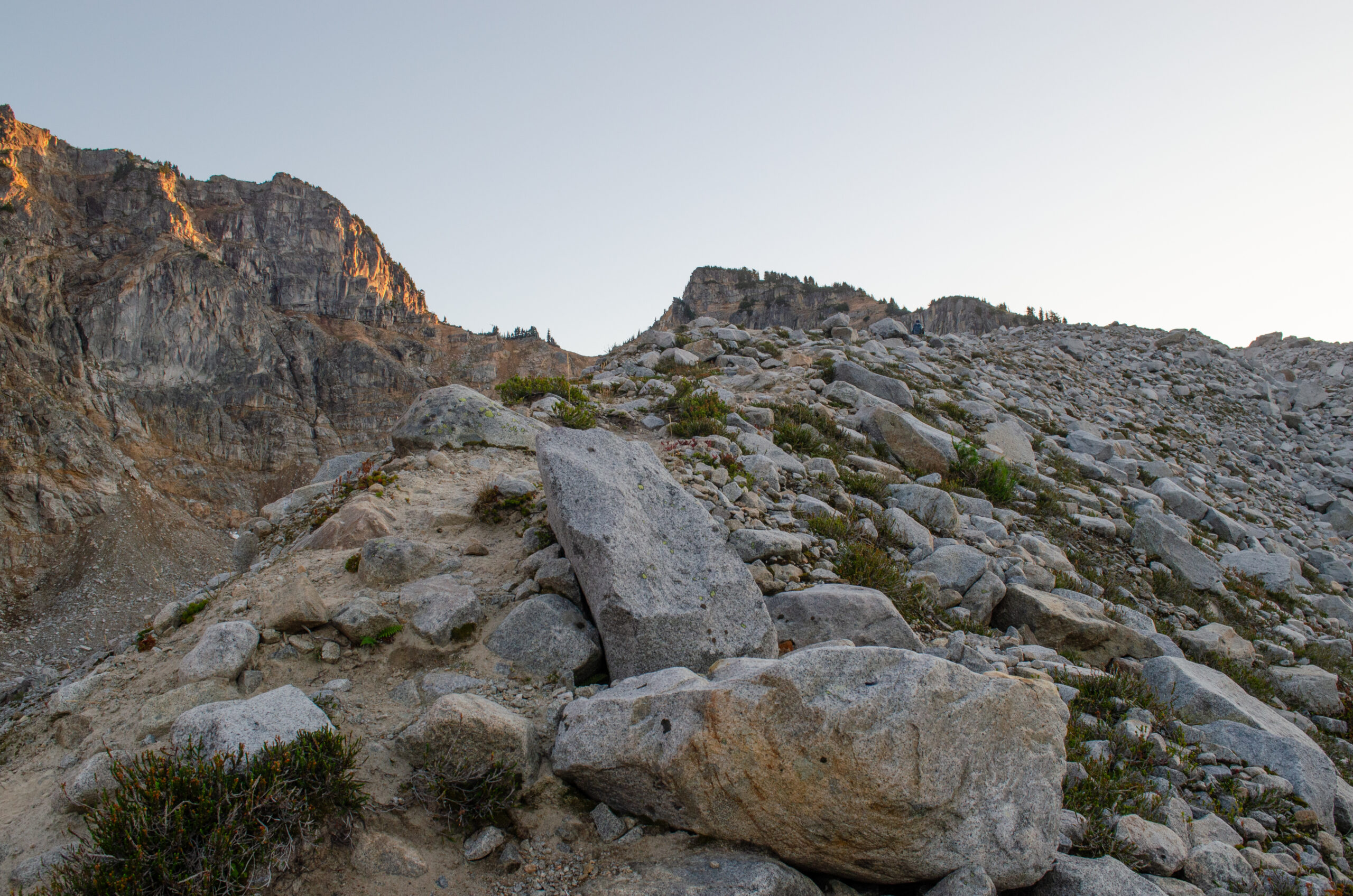
The final push to Tank Lakes was rocky, steep and difficult. Scrambling was minimal but something to keep in mind for those with small children or dogs. Note that there is a dirt path that runs parallel (to the right) of the ridgeline for a section – this is different from the AllTrails route, so keep a lookout for it if you want to avoid hiking on scree.
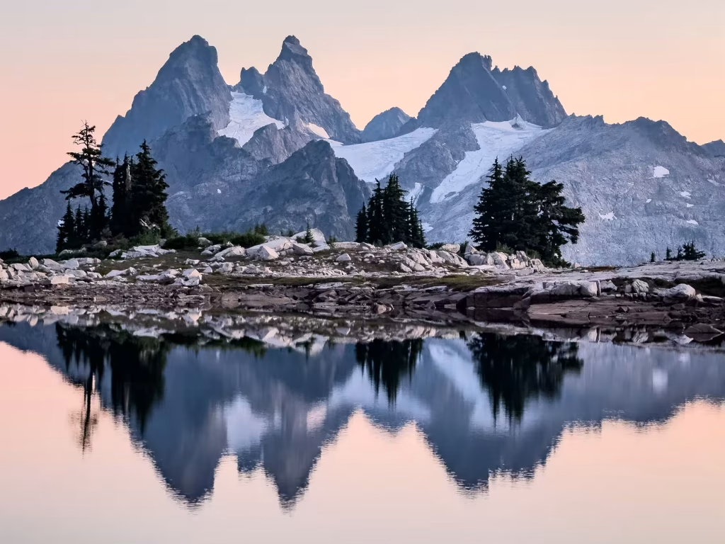
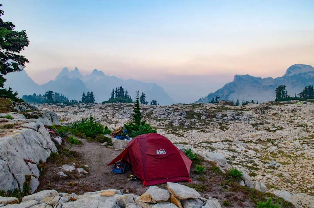
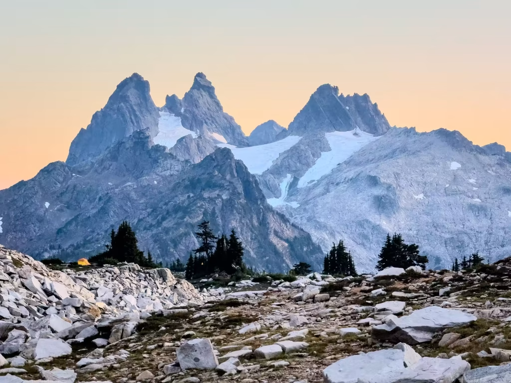
We reached Tank Lakes as the sun was setting and this view made the long day worth it. There were 4 other groups enjoying the sunset by the lake as well, and another group arrived in the dark while we were setting up camp and preparing dinner. It didn’t feel crowded at all as there was so much space for the groups to spread out between campsites.
Day 2
We set an early alarm to capture sunrise photography and woke to the smell of smoke in the air. The winds overnight blew a significant amount of nearby wildfire smoke through the area. This created a very hazy, soft pink sky, but prevented us from seeing any detail of the surrounding mountain peaks. We took our time this morning enjoying the area and packing up slowly before leaving our campsite at noon.

The 5.5 miles between Tank Lakes and the Necklace Valley floor felt worse descending compared to the climb upwards the day before. Perhaps it was fatigue, or simply strain on the knees, but it was difficult to move quickly. By the time we reached the valley floor, we were relieved to be done with any semblance of elevation, but were now fighting the clock in order to reach our cars before dark. Alas, the forest canopy welcomes darkness sooner than expected, so we spent the last 3 miles hiking with headlamps on.
We reached our car just before 8pm, exhausted from the past two days of long hours of hiking, humbled yet again by nature’s beauty and rugged trails.
Stats
- Note that my mileage stats were tracked using my Garmin Forerunner GPS watch, which was consistently 1 mile ahead of the AllTrails app and the trail markers. Nevertheless, these were the stats:
- Hike in: 11.5 miles; 4400’ gain. 10:45am start, 7:15pm end. Moving time 5h23m; elapsed time 8h30m (lots of breaks for rest and water filtering)
- Hike out: 12pm start, 7:58pm end. Moving time 5h47m; elapsed time just under 8 hours.
Pro Tips
- We tried out some new gear on this adventure, all of which were lifesavers and we can’t imagine doing that hike without them: Leki trekking poles, a new Katadyn BeFree water filter, and a hands-free waist dog leash.
- It was a beautiful journey, but one that we wish we would have stretched over 2 to 3 nights to enjoy the area and rest more between the difficult stretches of hiking. We highly recommend doing this as a multi-night backpacking trip to make the most of this gorgeous area.
Happy adventuring!