Columbia River Gorge: Waterfalls & Wildflowers Galore
The Columbia River Gorge National Scenic Area follows the canyon that is carved by the Columbia River between Washington state and Oregon. It is our go-to area in the Spring (mid April through early June) if we are trying to avoid snow in the higher alpine elevation areas, and it’s a bonus that the weather forecast in this area is usually sunny and warm due to the “rainshadow effect.” We love coming here for the waterfalls & wildflowers, and the drive through the Gorge itself is one of our favorite scenic drives in the Pacific Northwest! This is also a prime location for windsurfing, kiteboarding, fishing and all sorts of water sports.
Scenic Drive: Historic Columbia River Highway
This 70-mile scenic drive along Highway 84 is astounding! You don’t even need to leave your car to take in the beauty of the Gorge. Legend has it that this may be America’s first scenic highway.
Starting on the Oregon side, driving from Portland eastward, here are some of our favorite stops that are easily accessed just off the highway:
First up is the Chanticleer Point Lookout at the Portland Women’s Forum. There is ample parking here and a great spot to view the famous Vista House from afar. Directions are here.

Drive less than 1.5 miles further east to actually reach the Vista House at Crown Point. There is a lot of parking here and admire the sweeping views of the river and canyon below.

Next up is the famous Multnomah Falls (keep scrolling for more trail details in the Waterfall Hikes section)

A short drive later is Horsetail Falls (no hiking required), and then Elowah Falls (2 mile hike round trip) after that. Drive another four miles from the Elowah Falls trailhead, and you’ll come across the Wahclella Falls, and then even further is Eagle Creek Trailhead to access a number of trails & falls (more trail details below!)


The next big stop is usually the Bridge of the Gods. This is a giant steel bridge connecting Oregon and Washington. If crossing by vehicle, there is a $3 toll, but you can also cross on foot or by bicycle. The Pacific Crest Trail goes through here!
- On the Oregon side, you will be in the town of Cascade Locks. Treat yourself to a latte at Thirsty Coffee Bar!
- If you cross over to the Washington side, we recommend grabbing a bite to eat at Red Bluff Tavern in the cute town of Stevenson, WA
Continuing east on the Oregon side, check out the newly opened Mitchell Point Tunnel. There is a small parking area off of eastbound I-84 at exit 58. There are picnic tables to rest, and great photo opportunities aplenty here.
Then, the next big town is Hood River, OR. There are many lodging, restaurant and activity options here. Full Sail Brewing is our go-to spot for food in this area! We dream about ending every hike with their salmon fish and chips.

Continue on past the cute little town of Mosier and Memaloose State Park (we can vouch for the campground here!) and find your way to Rowena Crest Overlook. This requires a bit of driving off of exit #69 – details are here. We haven’t actually been here yet, but it’s a pretty popular “Instagram” spot that’s on our bucket list!
The unofficial end of the scenic highway is at the town called The Dalles. We recommend crossing back over to the Washington side to explore the Columbia Hills Historical State Park for your nature fix. Stop at Horsethief Butte to stretch your legs, admire this landmark and the Columbia River below. Cross the road for the Crawford Oaks trailhead for one of our favorite wildflower trails (keep on reading for more information about this hike!)
Waterfall Hikes
Multnomah Falls
- TRAIL STATS:
- 0.1 to 2.4 miles – choose your own adventure – either walk a few steps to the base of the falls, hike less than a ⅓ of a mile to a closer viewpoint, or a little under a mile (one-way, and it’s steep) to reach the top of the falls.
- Dog friendly? Yes, leashed
- Permits: Northwest Forest Pass
- *if you’re visiting during peak season between Memorial Day (late May) and Labor Day (early September) between 9am-6pm, you will also need to purchase a timed entry permit. This can be reserved online for $2/car up to 2 weeks in advance. There is also a small supply of free permits that can be obtained at the Gateway to the Gorge Visitor Center and the Cascade Locks Historical Museum.
- Getting There: from Portland, there is an off-ramp to the left to access a large parking lot off of Exit 31 off of I-84.
- Note that reserving a time entry permit does not guarantee that you’ll find a parking spot!
- This is likely the classic image that folks conjure up when they think of the Columbia River Gorge. It is more popular than an In-N-Out on a Friday night and will be teeming with crowds – you have been warned!
- This area is very family friendly, and the parking lot leading up to the visitors center and the base of the falls is all accessible. Near the visitor center, there are restrooms, snacks for sale and a gift shop.
Wahclella Falls
- TRAIL STATS:
- 2.4 miles lollipop loop; easy; 350’ elevation gain
- Dog friendly? Yes, leashed
- Permits: Northwest Forest Pass
- Getting There: there is a small parking lot at the trailhead here
- This popular family friendly hike is magical, mossy, and takes you right into the heart of the base of the waterfalls, surrounded by steep canyon walls. Most of the trail is rocky but still doable with kids or beginner hikers.

Lewis River Falls
- TRAIL STATS:
- 10 miles out and back for all 3 falls; moderate; 1,250’ elevation gain
- This represents us hiking to all 3 waterfalls, which is a long day! Shorten this trip by only hiking to one or two of the falls instead, or parking at a closer trailhead
- Dog friendly? Yes, leashed
- Permits: Northwest Forest Pass
- During peak summer months (June 15 – September 15), you will need to reserve an additional permit to access the Lewis River Recreation Area. You can do this online.
- Getting There: There are multiple access points to this trail and parking lots that are much closer to each of the waterfalls, but we wanted to do one big long out-and-back, so we started at the Crab Creek Trailhead and hiked north.
- The Crab Creek Trailhead does not have a formal parking lot or a pit toilet but is along a wide road that would accommodate multiple cars.
- If you’re looking for amenities (pit toilet, trash cans, picnic tables and benches), your best bet would be to park at the Lower Falls Recreation Area, which is a few miles north of Crab Creek TH
- The Crab Creek Trailhead does not have a formal parking lot or a pit toilet but is along a wide road that would accommodate multiple cars.
- 10 miles out and back for all 3 falls; moderate; 1,250’ elevation gain
- From Crab Creek TH, access Lewis River Trail #31, and you’ll start your hike with the river to your right as you meander through a beautiful mossy forest. In 1.5 miles you’ll reach the Lower Lewis River Falls, but you’ll hear the roar of the water first. There is a large day use area and campsites nearby.
- Another 1.5 miles further on you’ll start to see signage for the Middle Falls. You’ll come across a small parking lot- just keep going through that, and then to your right, you’ll see the trail to continue on to Middle Falls. Middle Falls does not have the dramatic height or roar as its siblings, but rather more known for it being a “slip n slide” in the summer heat.
- Once you are ready to move on from Middle Falls, continue on towards Upper Falls. Once we were about 5 miles into the hike, we reached the base of the Upper Falls – what a beaut! This is a large area – a perfect sunny spot for our lunch break before the final stretch to the top of the Upper Falls. This last ⅓ of a mile to the top of the Upper Falls is the most elevation gain in the entire hike. This area is very small with minimal fencing/barriers – in other words, this can be a very dangerous spot if slippery and wet! We snapped a few photos and then turned around to head all the way back to Crab Creek Trailhead


Eagle Creek Trail to Punch Bowl Falls & Tunnel Falls
- TRAIL STATS:
- 4 miles roundtrip to Punch Bowl Falls (easy, flat), 12 miles roundtrip all the way to Tunnel Falls
- Dog friendly? Yes, on leash
- Permits: Northwest Forest Pass
- Getting There: Eagle Creek Trailhead is the same trailhead for both of these waterfalls
- Access both of these waterfalls from Eagle Creek Trail (Trail 440). You will arrive at Punch Bowl first, about 1.9 miles into your hike. Either view Punch Bowl Falls from the main trail, or take a short detour down towards the falls themselves. Turn around here and go back to the trailhead to complete your easy, 4 mile roundtrip hike, or continue on to your final destination of Tunnel Falls (6 miles from the trailhead).
- Aptly named, you will pass through a natural tunnel to actually view the Falls from behind – a unique experience! If you do decide to continue on to Tunnel Falls, know that you will gain 1000 more feet of elevation, and the trail can be narrow with steep drop-offs at times.


Ramona Falls
- TRAIL STATS:
- 7 miles round trip, loop trail, moderate 1k’ gain
- Dog friendly? Yes
- Permits: Northwest Forest Pass
- Getting There: Ramona Falls Trailhead
- This epic hike is quite the adventure, as you encounter a river crossing about 1 mile into your journey. Be prepared for this, and do not cross the river if it is swiftly moving. It’s best to wait til at least mid-summer for the river to calm down. Continue on until reaching the falls, which you can admire from a nice footbridge from it’s base.

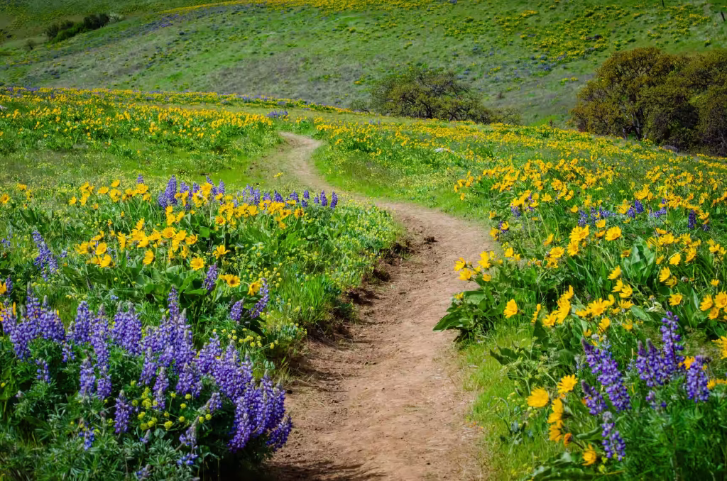
Wildflower Hikes
Remember to stay on the trail so as to not trample our delicate flora, and of course, do not pick the wildflowers! Leave them be, leave no trace.
Also note that peak bloom of the wildflowers will vary by hike/location – usually the further east along the Gorge you go, the earlier the flowers will bloom. For example, Dog Mountain blooms may not peak till mid May, whereas hikes in the Columbia Hills Scenic Area peak in mid to late April.


Columbia Hills Vista Loop
- TRAIL STATS:
- 6.5 miles; lollipop loop; moderate; 1,300’ elevation gain
- Dog friendly? Yes, leashed
- Permits: Discover Pass (Washington state)
- Getting There: park at the Crawford Oaks trailhead. This is a small parking lot for cars and also a few spots for RVs/trailers, and a pit toilet here.
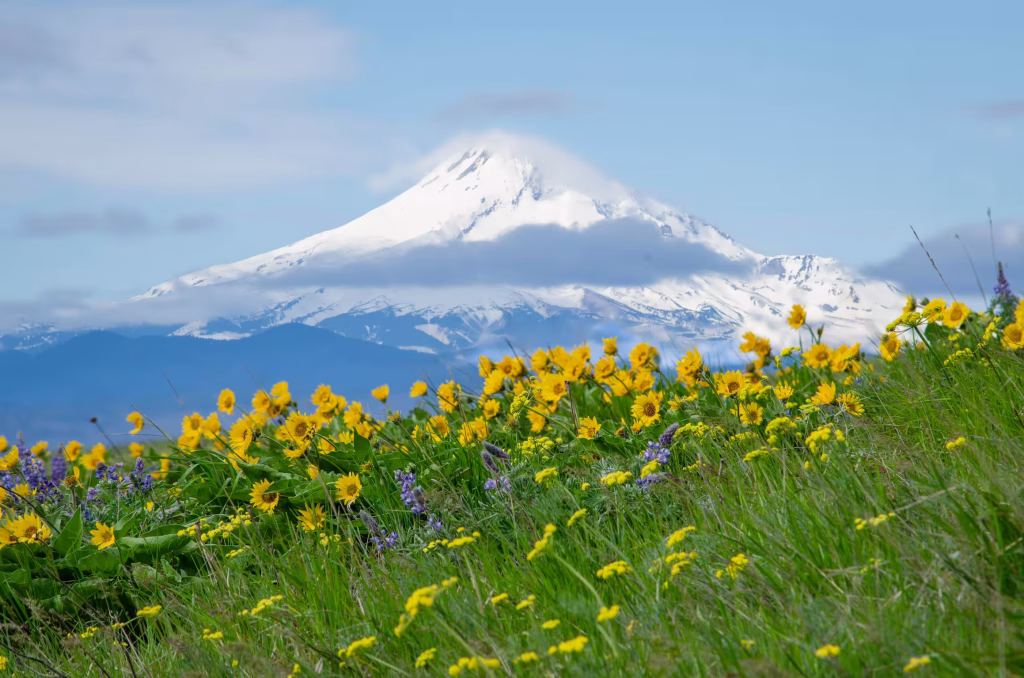
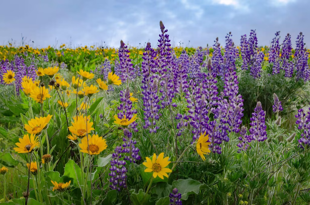
- Start your hike by following a gravel road upwards – on a clear day you’ll already have Mount Hood in plain view. After crossing a small creek, you’ll reach a fork where you the loop trail starts. Here, the valley opens up and balsamroot and lupine can be seen in every direction. We did the loop clockwise so that we could have Mount Hood in front of us for the descent on the second half of the loop.
- Pro tip: once you reach the section along the ridge where you can view the Columbia River below you, it is usually very windy. The wind tunnel effect is strong – don’t forget your windbreaker and layers!
- Note that this is a multi-use trail, so you may share the space with mountain bikers and equestrians

Mosier Plateau
- TRAIL STATS:
- 3.5 miles, out and back, easy to moderate, 600’ elevation gain
- Dog friendly? Yes, leashed
- Permits: none
- Getting There: park directly at Mosier Trailhead by a large totem pole. Cross a bridge to start the hike.
- After passing by a cemetery and then a waterfall, you’ll encounter several trailheads, and the wildflowers just keep coming! At the top, you’ll see fields full of wildflowers, and eventually reach the viewpoint with a small seating area with a few benches. This vista of the Columbia River from across the highway with the array of wildflowers is gorgeous, especially if you can catch this view at sunset, like we did!


What’s left on our Gorge bucket list?
- Falls Creek Falls
- Dog Mountain
- Memaloose Hills
- Rowena Crest Overlook & Tom McCall Point
- Lyle Cherry Orchard
Looking for more of our favorite wildflower hikes outside of the Columbia River Gorge area? Check out our other Adventure Guide! Happy adventuring!