Chelan Lakeshore Trail: Backpacking to Stehekin
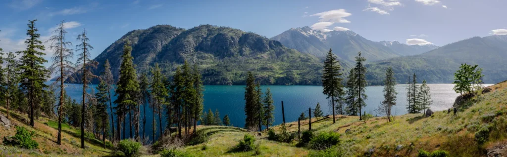
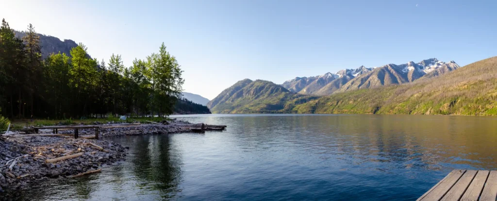
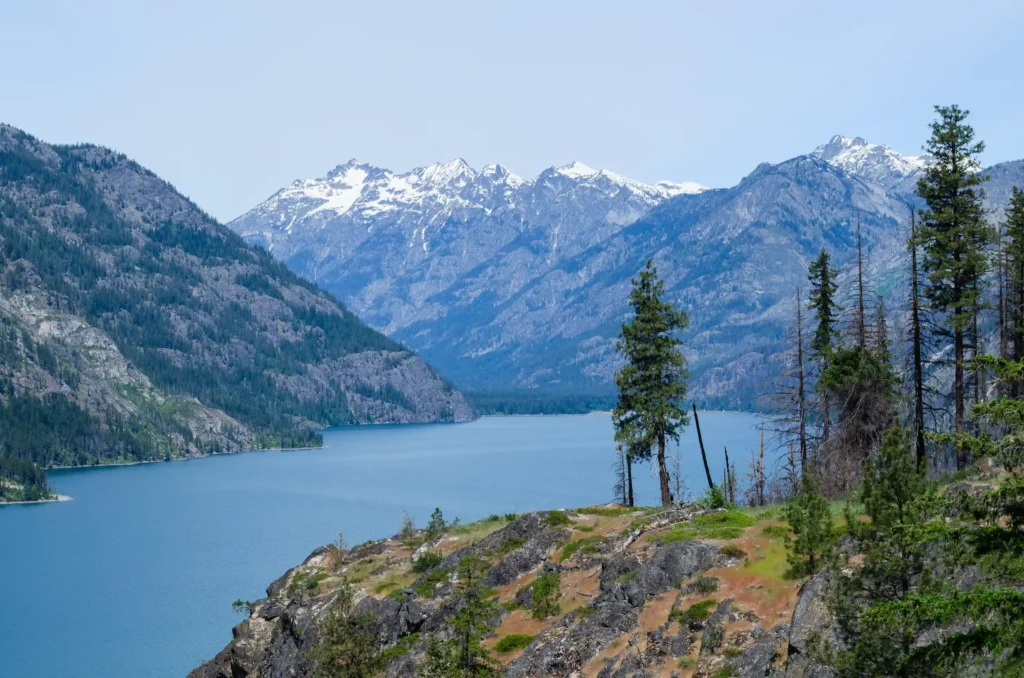
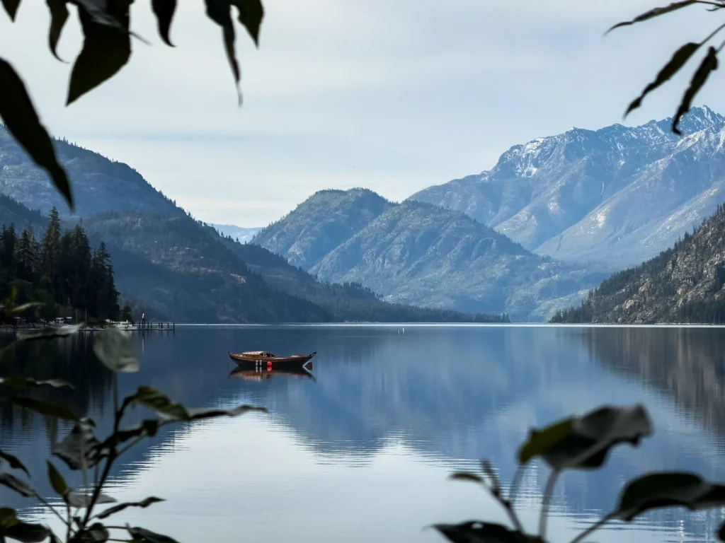
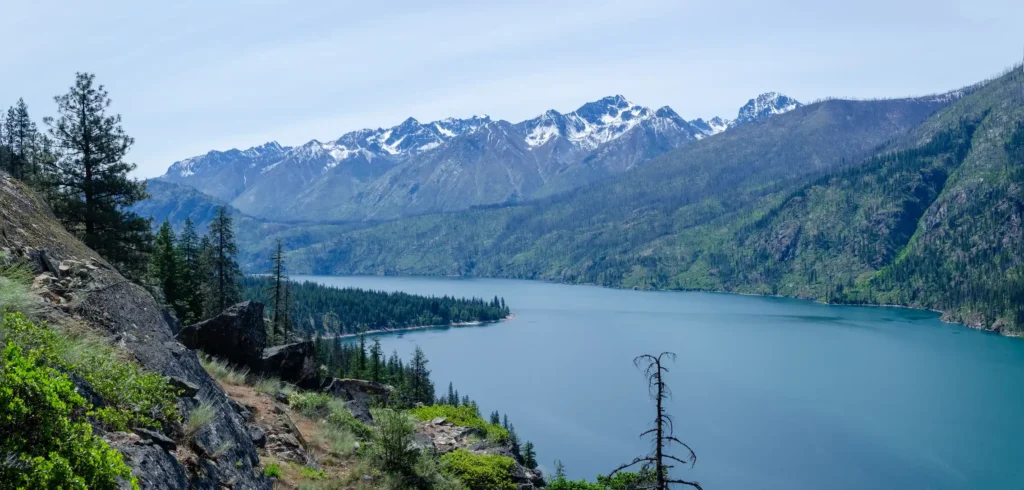
Lake Chelan is a 50 mile long, narrow, winding lake that could easily be mistaken for a river from a bird’s-eye view. It sits in central Washington, stretching northwards from the small city of Chelan to the gateway of the North Cascades National Park. It is the third deepest lake in the United States, formed by eons of glacial movement.
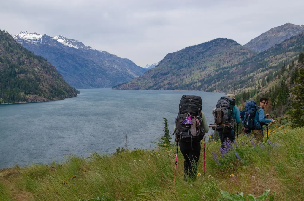
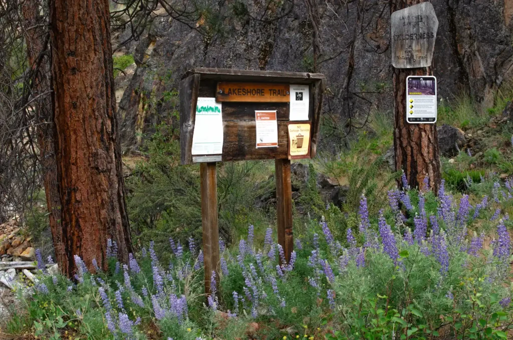
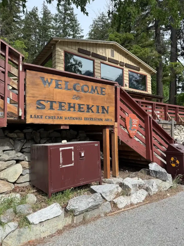
The Lakeshore Trail is a dog-friendly, 17-mile point-to-point hike along a portion of Lake Chelan. Most hikers start at Prince Creek and hike north, ending at the community of Stehekin. Stehekin itself is a cute and unique destination: this small mountain town has no road access – you can only reach it via ferry/boat or by hiking in.
We did this as a two-night/three-day backpacking trip in early May 2026. Please note that this trail is usually known for being an easy to moderate, family-friendly backpack, but the flooding from December 2025 resulted in damage to the trail that increases the difficulty level. That being said, at least for the 2026 hiking season, this trail is best reserved for hikers that are comfortable with some level of route finding and navigating some rough trail conditions (washouts, water crossings, downed trees). Read on for more details for planning your Lake Chelan adventure!
When To Go?
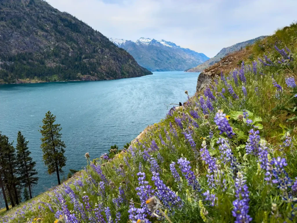
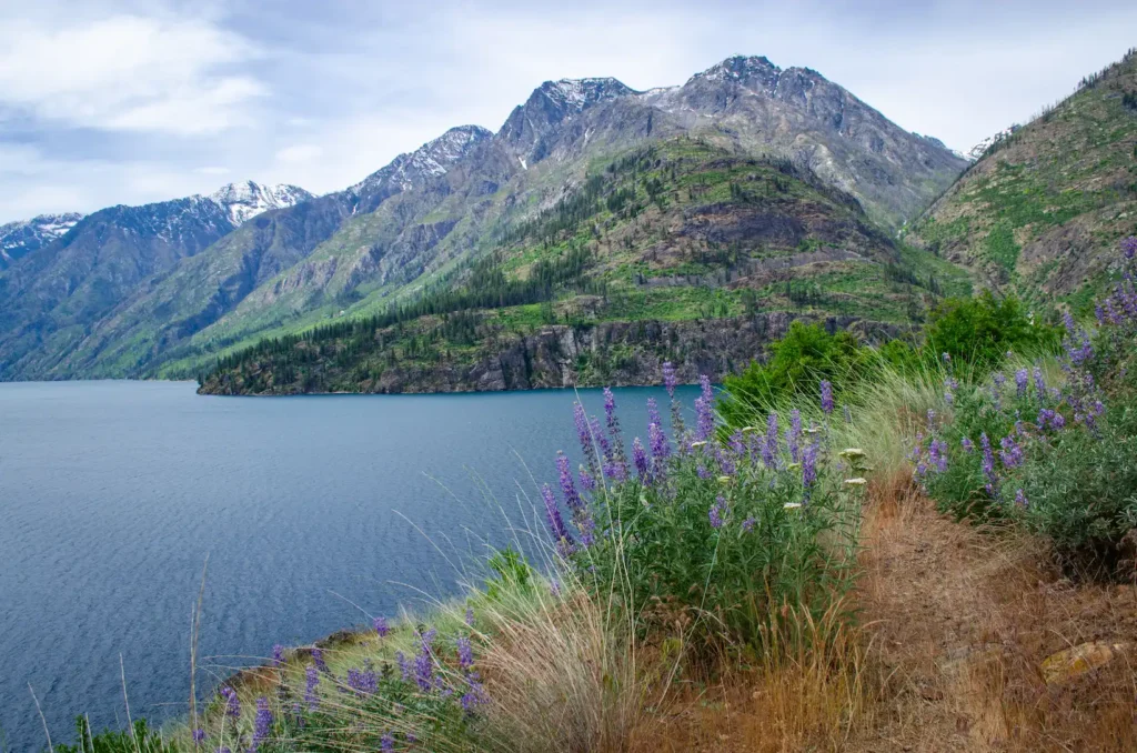
This trail is most popular in May for those looking for an early season backpacking trip avoiding snow, and because the Spring wildflowers are abundant! Summer is also popular, but this trail is very exposed so you should be prepared for the heat and the sun.
Permits & Parking
No permits are needed to hike; however there is a fee for overnight parking at the ferry landing docks. There are two places to catch the ferry: Chelan or Field’s Point Landing. In 2026, the cost for overnight parking at Field’s Point Landing was $9/night and we were able to pay via credit card at the visitors center. If you want to start your trip from the dock in Chelan (further south down the lake), the cost may be a little more expensive, starting at $12/night. You will be given a parking pass to display on your dashboard after payment.
Getting There
As mentioned above, most hikers start at Prince Creek. If you want to cut your hiking short, you could also ferry to Moore Point, or even directly to Stehekin. Nevertheless, you will have to book a ferry ride. The ferry will either pick you up from the Chelan dock (1418 W. Woodin Ave, Chelan, WA 98816), or from Field’s Point Landing (17100 S. Lakeshore Drive, Chelan, WA 98816), which is accessed by driving another 17 miles up the lake. We chose to park at Field’s Point Landing in order to have a quicker ferry trip since we had our dog, and pets are required to be on the outer deck of the Lady Express Ferry during the trip.
You can purchase your ferry tickets online in advance. There are two main ferry systems you can book through. For our schedules, we used the Lady of the Lake to go uplake. Then, for our return trip downlake, we made reservations through the Stehekin Ferry. Note that if bringing a bicycle, extra luggage or a pet, there are additional fees (which vary based on which ferry company or boat you select).
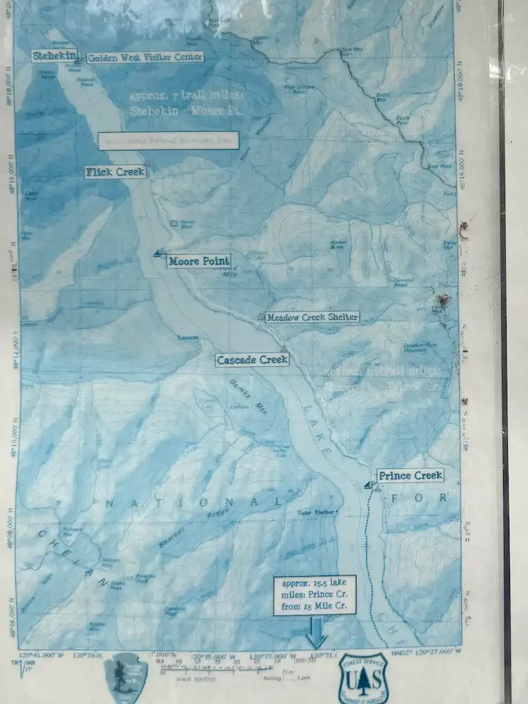
The Trail & Campgrounds
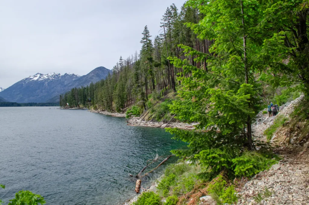
The entire trail is 17.5 miles one-way with 4,000 feet of elevation gain. The elevation gain was rolling throughout the trail with only a few short climbs. The most difficult part of the trail is the near constant exposure to sun and wind. In spring, there are many opportunities to filter water along the trail.
It is also important to note the presence of wildlife: rattlesnakes are common (we saw two), bears frequent the area (we did not see any), and your usual deer (a group of them took a liking to our camp at Lakeview Campground), lizards, and ticks are present too.
The approximate distances between campgrounds from South to North are:
- Prince Creek to Cascade Creek: 5.7 miles
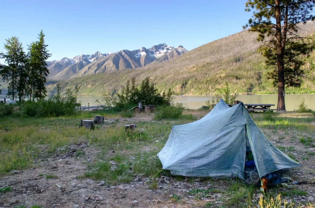
- If you stay at Prince Creek (mile 0), there are 6 tent sites here, multiple fire rings and picnic tables, 2 toilets and a bear box
- Cascade Creek has 2 proper tent sites with some extra room for dispersed camping, 1 picnic table and 2 toilets
- Cascade Creek to Meadow Creek Shelter: 1.3 miles
- Meadow Creek does not have direct lakeshore access though there is a creek nearby for water, a nice large shelter, a vault toilet (not covered, though there are walls), and multiple dispersed campsites
- Meadow Creek Shelter to Moore Point: 3.5 miles
- Moore Point is the largest campground with multiple tent sites, fire rings and picnic tables, lakeshore access and a dock, toilets, and a bear box
- If Moore Point is full, there is a primitive camping area called Orchard Point nearby that is further away from the shore. There is signage for this as you approach Moore Point from the main Lakeshore Trail – you will turn left for Orchard and right for Moore
- Moore Point to Flick Creek: 3.5 miles
- Flick Creek is a small campground with 2 tent sites, a shelter, bear box and a vault toilet. It is right on the lakeshore
- Flick Creek to Stehekin (Lakeview and Purple Point Campgrounds): 3.5 miles
- After leaving Flick Creek, you will enter the North Cascades National Park Service Complex, and the campgrounds are managed by a National Park Service concessionaire called Guest Services. Normally, you would need to make reservations to stay at these campgrounds at www.recreation.gov, but for the 2026 season, services were limited due to the 2025 storm damage, so everything was first-come, first-served. More updates from the NPS can be found here including links to the reservation system (if needed for future seasons)
- Lakeview Campground has 9 tent sites but fires are not allowed
- Purple Point Campground has 6 tent sites, but one of those was closed as of 5/8/2026. There are fire rings here
The Experience
Day 1 (May 8, 2026):
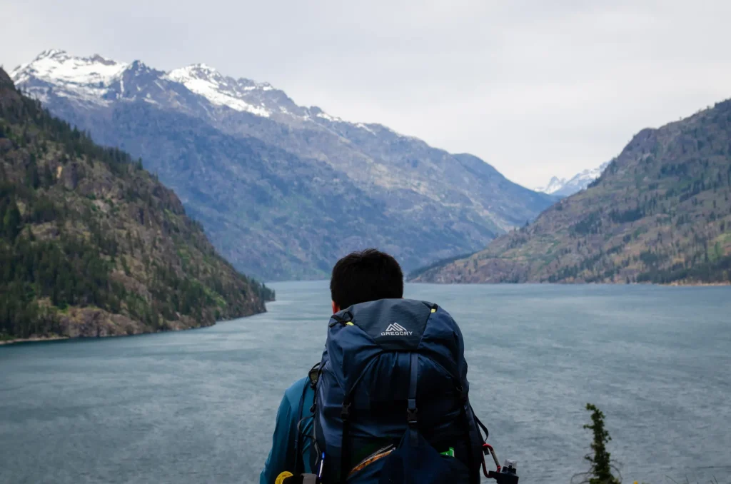
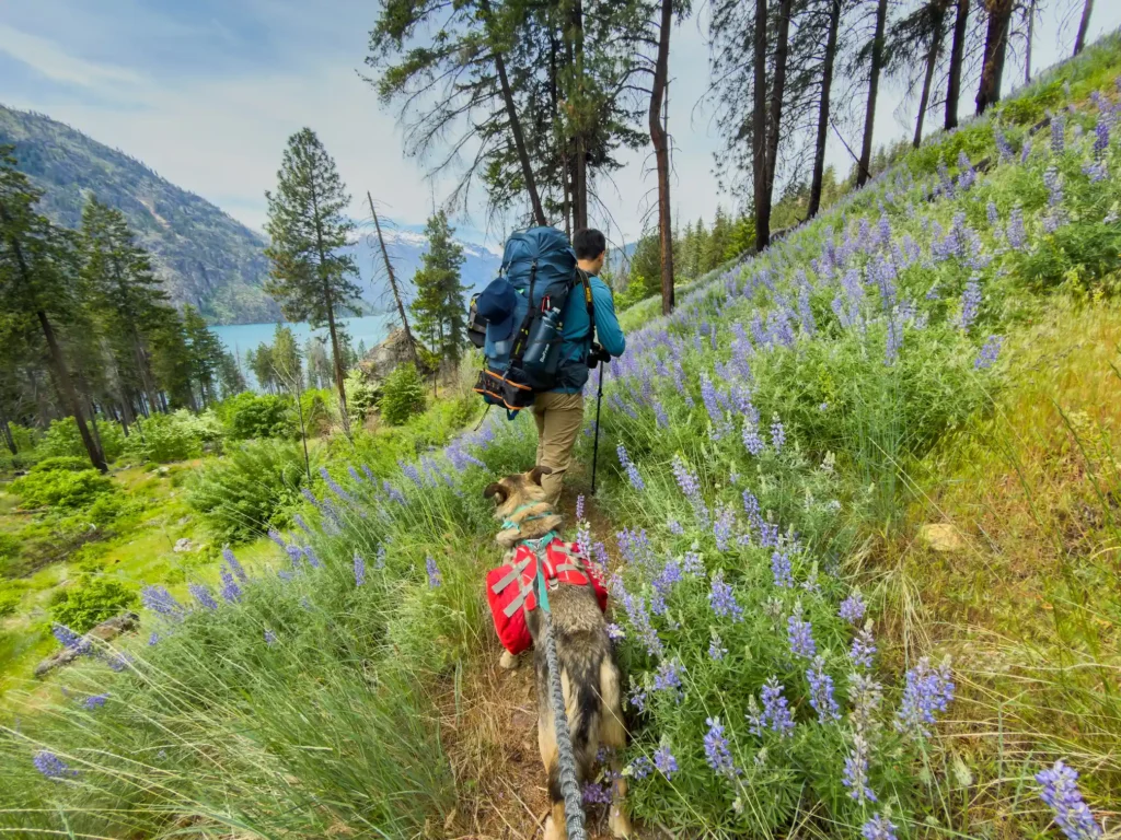
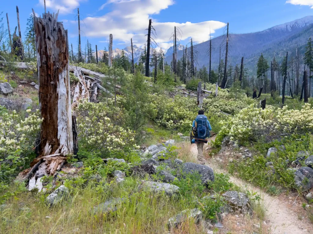
We caught the early morning Lady of the Lake Express Ferry from Field’s Point Landing to Prince Creek. The departure time from Field’s Point was 9:15am, and we landed at Prince Creek at 10:15am. We hiked through the Prince Creek campground, crossed a bridge and the trail started climbing. It wasn’t long before we could see the lake below us and panoramic views at every turn. There was lupine in full bloom everywhere.
About 3 miles into the hike we came across a rattlesnake loudly rattling at us. We were able to scare it away with rocks in order to safely pass around it. Then, probably less than 5-10 minutes of hiking later, we encountered a second rattling rattlesnake on the trail! Both of these encounters in close proximity to one another was jarring, so we spent the next few miles tiptoeing along the trail on edge, resulting in a pace that was much slower than usual. It is well known that rattlesnakes enjoy sunbathing in this section of exposed, rocky trail, so be aware and watch your step!
We reached Cascade Creek by mid-afternoon and ran into a WTA party doing wonderful work fixing up the trail! As mentioned earlier, this trail sustained significant damage from the previous winter’s floods. There were still some downed trees, minor washouts and large sections of overgrown, brushy areas, but nothing that was overly challenging or concerning.
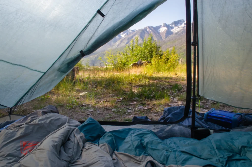
We continued on to Meadow Creek where we stopped for a snack break before the final push to Moore Point. By the time we reached Moore Point I had clocked 11.5 miles and it had been quite a long day (including the early morning drive and ferry ride), but having a lakeside campsite made it 110% worth it. We were impressed with the state of the campground, its size and the amenities. We saw a few bats flying around after sunset, but bugs were not really an issue.
Day 2 (May 9, 2026):
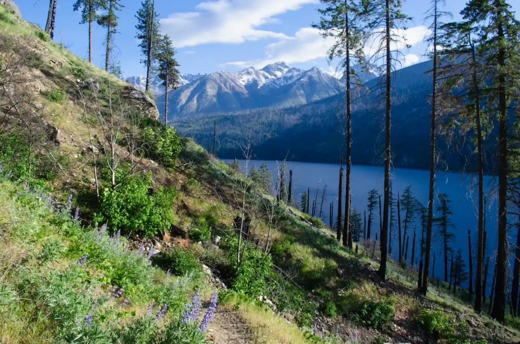
We had a lovely, relaxing morning at camp before starting our final stretch of hiking to Stehekin. We packed up camp and hit the trail at 10am. The postcard views continued as the landscape changed before our eyes – there was more greenery, a few more shady areas, and the last few balsamroot flowers. It was sunnier this day, so the calm blue of Lake Chelan below us somehow glistened even more brightly than the day before.
This stretch between Moore Point and Stehekin was much more technical and slow-going. Flick Creek is the halfway point, so we enjoyed a nice lakeside lunch here before tackling the roughest section of trail. Shortly after Flick Creek, there is a water crossing at Four Mile Creek where we had to change into sandals to wade across. Based on prior trip reports, there used to be a bridge here that most likely washed away from the flooding of December 2025.
All of the obstacles were worse than the previous day: the downed trees were larger and took more time to maneuver around or over, and there were more sandy, rocky washouts to navigate through. If you are planning on hiking this in 2026, see my trail report for more detailed beta that may only be applicable for this hiking season.

The final mileage for this day was 7 miles, but our pace was much slower than average because of the trail conditions. We finally reached Stehekin at 4:30pm and were beyond ready to dip our toes in the cold, refreshing water of Lake Chelan.
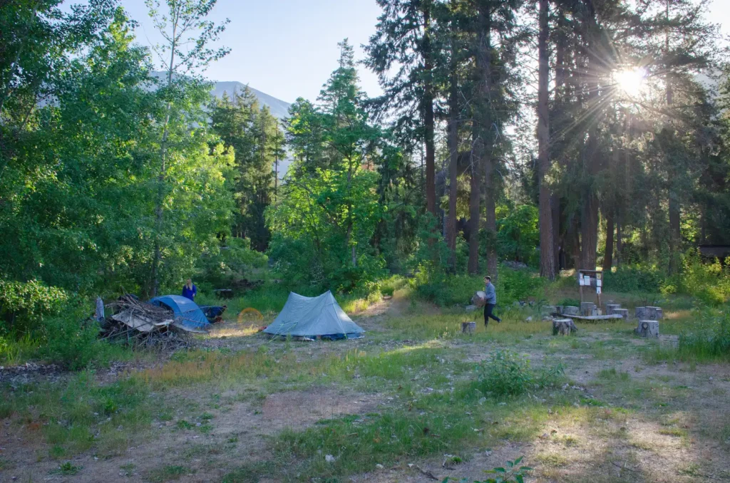
However, before actually entering the town and landing dock of Stehekin and Lake Chelan herself, you will come across Lakeview Campground.

If you want to continue on to Purple Point Campground, you will have to walk through the Stehekin Landing another half mile past the dock.
Unfortunately neither campground had direct lakeshore access and all of the Stehekin amenities were closed due to the aforementioned damage. Usually, the appeal of hiking to Stehekin as the end destination is to reward your hard-earned trail miles with a nice meal and public showers at the Lodge at Stehekin! But this means we will have to return a different year when they reopen.
Day 3 (May 10, 2026):
No hiking this morning! Our only objective this day was to obtain cinnamon rolls and other goodies at the Stehekin Pastry Company. We ordered hot drinks and food, and were particularly pleased by the savory filled croissants.
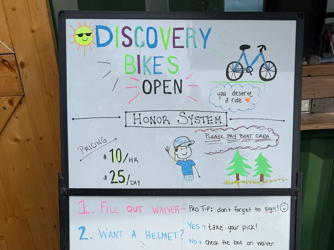

The Stehekin Pastry Company is a 2 mile one-way trek along a flat road from the Stehekin Landing dock. It is an easy walk, but we decided to rent bikes at a small kiosk near Purple Point Campground called Stehekin Discovery Bikes. The short bike ride was gorgeous as most of the road followed the lakeshore.

Then, we packed up camp and caught the 10:40am Stehekin Ferry back to Field’s Point. All of the seating for this ferry was enclosed inside a comfortable cabin. It was fun to look back at where we were hiking along the Lakeshore Trail from the middle of the lake!
Overall, this was a super fun and memorable trip. It was the perfect difficulty level for the first backpack of the season, and a great way to find warmth and sunshine when the Springtime weather on the western side of Washington is usually unpredictable.
If you wanted to spend even more time in Stehekin, or to extend your trip further north beyond Stehekin, check out these other items of interest in the area:
- Stehekin Bee Farm for local honey
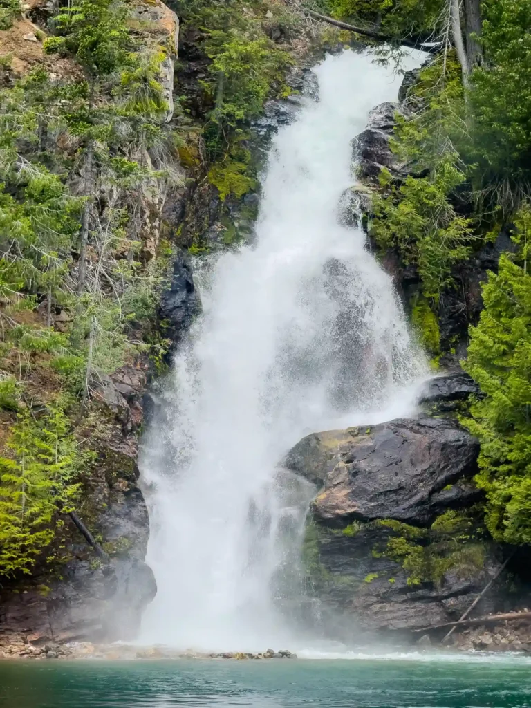
- Rainbow Falls trailhead is another 1.5 miles past Stehekin Pastry Company
- Stehekin Outfitters horseback riding
- Stehekin Garden
- Buckner Orchard
- Stehekin Valley Ranch- make reservations here for a nice dinner
Happy adventuring!